Mapping the Future: A Guide to Geographic Information Systems
Written by: Clyde Christian Anderson
What is a Geographic Information System?
A Geographic Information System is a computer-based framework that captures, stores, analyzes, and displays data related to positions on Earth's surface. It connects location data (where things are) with descriptive information (what they're like) to help users understand patterns and make better decisions.
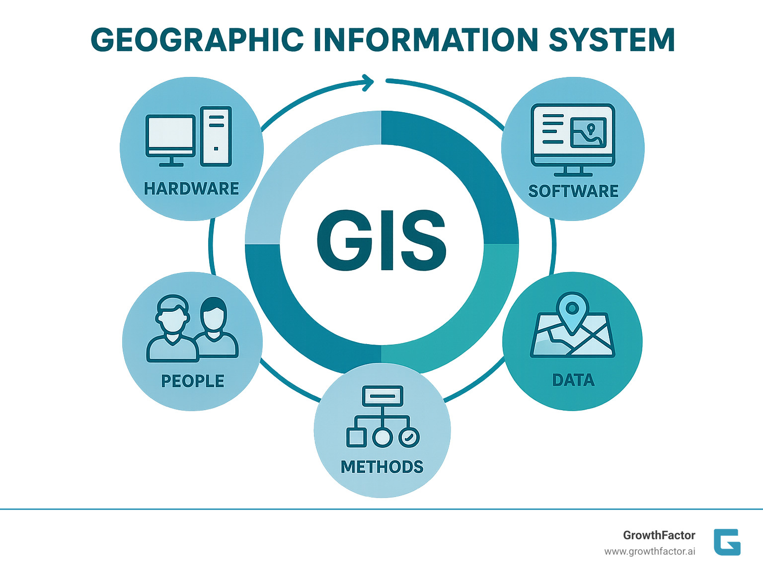
Key Components of a Geographic Information System:
- Hardware: Computers, servers, and mobile devices
- Software: Programs like ArcGIS, QGIS, or specialized platforms
- Data: Spatial and attribute information
- People: Users and analysts who operate the system
- Methods: Workflows for analysis and decision-making
Unlike simple mapping tools, a GIS links spatial data with databases, enabling complex analysis that reveals deeper insights into patterns and relationships. This helps users make smarter decisions. Approximately 80% of all information in databases contains a geographic element, making GIS technology crucial across nearly every industry.
Common Applications:
- Business: Site selection, market analysis, customer targeting
- Government: Urban planning, emergency response, resource management
- Science: Environmental monitoring, disease tracking, climate research
- Engineering: Infrastructure design, utility management, transportation planning
I'm Clyde Christian Anderson, Founder and CEO of GrowthFactor.ai. We use AI-powered GIS platforms to help retail clients find profitable locations, processing thousands of potential sites and reducing evaluation time by 80%.

How GIS Works: The Core Components and Processes
A Geographic Information System doesn't just show you locations; it reveals the stories behind them. While a regular map shows where coffee shops are, GIS can identify neighborhoods with the highest concentration of coffee lovers, peak foot traffic, and even predict the best spot for a new café.
The process involves data capture, storage, analysis, and visualization. It begins with data capture from sources like satellites, GPS, and surveys. This information is stored in sophisticated database management systems.
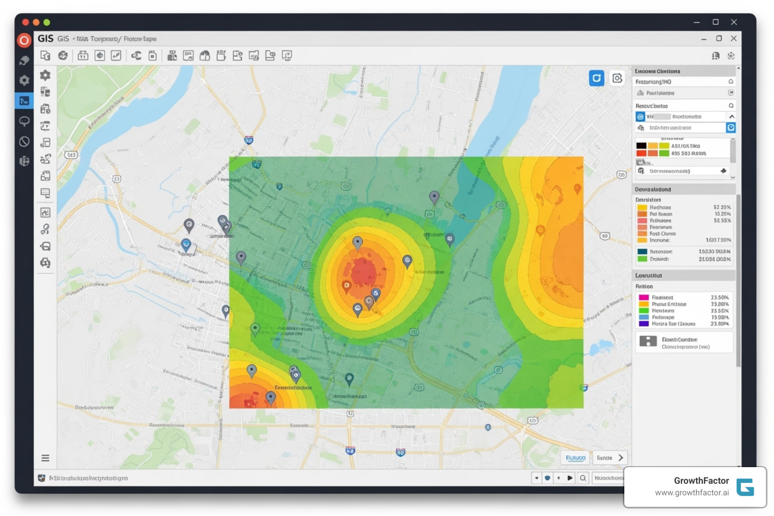
The most powerful step is spatial analysis, where GIS answers complex questions. For example, it can find all parks within five miles of hospitals or overlay population density with flood zones. Geoprocessing manipulates this data further through operations like buffering (creating zones around features) or merging data layers. Finally, cartography and data output transform these insights into clear, compelling maps and visualizations.
To understand how GIS stands apart, see how it compares to other systems:
| Feature | Geographic Information System (GIS) | Computer-Aided Design (CAD) | Database Management System (DBMS) |
|---|---|---|---|
| Primary Focus | Spatial analysis and geographic relationships | Precise drafting and design with no geographic context | Storing and managing data efficiently |
| Data Type | Location data linked with descriptive information | Geometric shapes and lines for design work | Numbers, text, and relationships in tables |
| Key Capability | Pattern detection, site analysis, network modeling | Drawing, editing, and rendering precise designs | Data storage, querying, and reporting |
| Example Use | Finding optimal retail locations, mapping demographics | Creating building blueprints or product designs | Managing customer records or inventory |
Core Components of a Geographic Information System
A GIS relies on several core components working in harmony. Hardware provides the foundation, from powerful workstations to mobile devices. Software orchestrates all spatial operations. Geographic data combines spatial information (the "where") with attribute data (the "what"). Personnel bring the expertise to interpret results and make strategic decisions. Finally, methods provide the standardized workflows that ensure consistent, reliable results. At GrowthFactor, our AI tools like Agent Waldo streamline these processes, but human judgment remains crucial.
For deeper insights into how AI improves these components, check out our guide on AI Location Intelligence.
The GIS Process: From Data to Decision
The journey from raw data to business insight follows a clear path:
- Data acquisition gathers information from sources like satellite imagery, census data, or GPS coordinates.
- Data processing cleans and standardizes this raw material so different sources can be integrated.
- Data management organizes the processed information in a robust database, keeping spatial and attribute data connected.
- Query and analysis is where GIS answers complex spatial questions, revealing market gaps or unexpected patterns.
- Visualization transforms analytical results into clear maps and charts that stakeholders can easily understand.
This systematic approach ensures every geographic question gets a thorough, reliable answer. For more technical background, the USGS Geographic Information Systems guide is an excellent resource.
The Language of Location: Understanding GIS Data

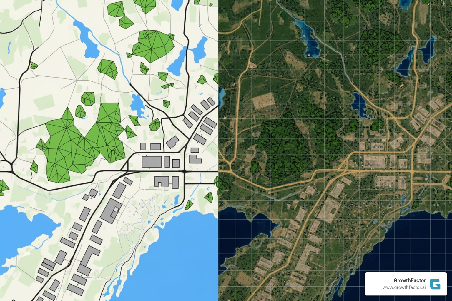
A Geographic Information System represents the world using two primary data models: vector and raster. At its heart, GIS combines spatial data (where something is) with attribute data (what it's like). Think of spatial data as the "where" and attribute data as the "what, when, and why."
Vector data uses precise points, lines, and shapes for features with clear boundaries. Raster data works like a digital photograph, dividing the world into a grid where each square holds information about that spot.
Every piece of spatial data also comes with metadata—the data's biography. It tells us who created it, when, its accuracy, and its projection. Without metadata, spatial data lacks context.
Vector Data: Points, Lines, and Polygons
Vector data is ideal for representing discrete data—things with exact locations and clear boundaries.
- Points represent specific locations, like a potential retail site on a map. These points can carry rich attribute data, from foot traffic counts to local demographics.
- Lines connect points to represent linear features like roads, rivers, or utility lines. We use lines to map transportation networks, helping clients understand customer access.
- Polygons are closed shapes representing areas like city limits, trade areas, or market territories. They help us understand the market a potential store would serve.
Vector data, often stored in shapefiles (.shp), offers mathematical precision for representing topography and boundaries, making it invaluable for detailed analysis. For more on how this drives strategic decisions, explore our guide on Real Estate Data Intelligence.
Raster Data: The World in a Grid
Raster data represents continuous data—information that changes gradually across a landscape, like temperature, elevation, or population density. It uses a grid of pixels or cells, where each cell holds a value for its location.
- Satellite imagery is a common form of raster data, where each pixel captures the color and brightness of a spot on Earth. This helps clients see ground-level details like parking lot sizes.
- Digital Elevation Models (DEM) are another powerful raster format, with each cell representing land height. This helps in understanding terrain and drainage patterns.
Raster data is often stored in formats like GeoTIFF, which embeds location information directly into the file. The real power of a GIS shines when it combines vector and raster data. For example, we can overlay vector polygons of market boundaries onto a raster layer of population density, creating a complete picture for informed decision-making. For other applications, bathymetric datasets use raster formats to map underwater terrain.
Real-World Applications: How GIS Drives Decision-Making
The true power of a Geographic Information System is evident in its real-world applications across diverse industries, where it has become the backbone of smart decision-making.

- Urban Planning: Planners use GIS to visualize zoning impacts on traffic, identify infrastructure needs, and site new schools based on population growth.
- Environmental Management: Scientists track animal migrations, model pollution spread, and monitor the effects of climate change.
- Disaster Response: Emergency officials map damage in real-time, identify at-risk neighborhoods, and plan evacuation routes.
- Public Health: Professionals track disease outbreaks, analyze health disparities, and plan the location of new healthcare facilities.
- Logistics and Transportation: Companies optimize delivery routes to save time and fuel, and engineers design more efficient road networks.
- Telecommunications: Engineers use spatial analysis to determine the optimal placement of cell towers based on terrain and population density.
Business and Retail Site Selection
For businesses in retail and real estate, a Geographic Information System is essential for a competitive edge. The right location is often the difference between success and failure.
- Market Analysis: Visualize demographic data on a map to see exactly where target customers live, work, and shop.
- Customer Segmentation: Map existing customer data to find spatial patterns that reveal where your best customers are clustered.
- Competitor Analysis: Overlay competitor locations with market data to find gaps in coverage and untapped opportunities.
- Site Suitability: Combine dozens of factors—traffic, visibility, demographics, and competition—into a single, comprehensive assessment to remove guesswork from site selection.
At GrowthFactor, our AI-improved platform automates much of this analysis. Our AI Agent Waldo allows teams to evaluate five times more sites efficiently, freeing them to focus on strategy. For more details, see our guides on Data-Driven Site Selection and the Retail Site Selection Process.
Environmental Science and Resource Management
GIS technology is also crucial for protecting our natural environment. Scientists and resource managers depend on it to tackle complex challenges.
- Wildlife Conservation: Biologists combine GPS tracking with habitat data to identify and protect critical wildlife corridors.
- Pollution Modeling: GIS can predict how oil spills might move or how contaminated groundwater flows, aiding in prevention and response.
- Sustainable Planning: Planners use GIS to balance economic development with environmental protection, identifying areas for low-impact growth.
- Resource Management: Foresters track timber inventories and fire risk, while water managers model the effects of drought on watersheds.
Organizations like NOAA and the U.S. Geological Survey rely on GIS for critical environmental analysis. For more information, you can explore USGS: Geographic Information Systems. To learn how technology improves environmental analysis, visit our insights on AI for Property Development.
The Evolution and Future of a Geographic Information System
The story of the Geographic Information System is one of technological breakthroughs. The concept of layering maps dates back to the 19th century, but the GIS revolution truly began in the 1960s. Roger Tomlinson, the "father of GIS," developed the Canada Geographic Information System (CGIS), one of the first computerized platforms for land inventory analysis.
Since then, GIS has evolved from room-sized mainframes to desktop applications, and now to web and mobile platforms. The rise of open-source software has democratized access to powerful GIS tools, making spatial analysis available to organizations of all sizes.
A career in this dynamic field requires a blend of skills. Spatial analysis is the foundation, while cartography is crucial for communicating findings. Database management and programming (especially Python) are vital for handling large datasets and automation, and remote sensing knowledge helps in extracting insights from satellite imagery.
The Future of the Geographic Information System
The future of GIS is being shaped by several key trends, making it smarter, faster, and more accessible than ever.
- Artificial Intelligence and Machine Learning: AI is revolutionizing GIS by automating the analysis of massive datasets. It can detect changes in land use or predict environmental shifts in minutes. At GrowthFactor, our AI Agent Waldo automates site qualification, enabling clients to analyze five times more locations with greater efficiency.
- Real-Time Data: The integration of live data from traffic sensors, social media, and IoT devices provides dynamic, up-to-the-minute insights for traffic management and disaster response.
- 3D Visualization: Detailed 3D models created from technologies like LiDAR are no longer science fiction. They provide richer context for urban planning, infrastructure design, and geological studies.
- Cloud Computing: Cloud-based platforms are democratizing access to powerful GIS tools and vast datasets without the need for expensive local hardware, fostering greater collaboration.
These advances point to a future where GIS is an integral part of everyday decision-making. To see how AI is changing real estate, read our insights on AI for Real Estate.
Frequently Asked Questions about GIS
Here are answers to some of the most common questions we encounter about Geographic Information System technology.
What is the main difference between GIS and regular mapping tools?
The key difference is analysis. Regular mapping tools like Google Maps are excellent for navigation and finding specific locations. A Geographic Information System, however, links maps to a powerful database, enabling complex spatial analysis. Instead of just seeing where things are, GIS helps you understand why by answering strategic questions. For example, a mapping tool shows you existing coffee shops; a GIS can identify areas with high foot traffic, specific demographics, and low competition.
What kind of computer do I need to run GIS software?
Traditionally, professional GIS software required a powerful Windows computer with significant RAM and a dedicated graphics card for intensive analysis. However, the rise of Web GIS and cloud-based platforms has changed the game. Today, you can perform sophisticated analysis on a standard laptop, tablet, or even a smartphone, as the heavy computational work is handled on remote servers. Our platform at GrowthFactor uses this cloud-based approach, making powerful location intelligence accessible from any device.
Can I learn GIS on my own?
Yes, absolutely. It's easier than ever to learn GIS through self-study. Many resources are available, including online courses, tutorials, and free open-source software like QGIS, which allow beginners to learn fundamental concepts and build practical skills. Platforms like Coursera offer university-level courses, and online communities provide extensive support. The best way to learn is by working on a project you care about, using freely available datasets from agencies like USGS and NOAA to answer a real-world question.
Conclusion: Using Spatial Intelligence for Growth
A Geographic Information System is a powerful bridge between raw data and meaningful understanding, connecting the "what" with the "where" to transform decision-making. It's the technology that helps planners design better cities, scientists track environmental change, and businesses find the perfect location for expansion.
For businesses in today's competitive retail and real estate markets, every location decision is a significant investment. The difference between a great site and a mediocre one can mean millions in revenue. This is where the analytical power of a Geographic Information System provides a critical advantage.
At GrowthFactor, we've seen how combining GIS with artificial intelligence creates extraordinary results. Our AI Agent Waldo doesn't just analyze data—it automates complex evaluations, helping teams process five times more potential sites than traditional methods allow. This isn't about replacing human judgment; it's about amplifying it with spatial intelligence.
The change happens when location becomes intelligence. Instead of spending weeks on manual data gathering, teams can focus on strategy. The future belongs to organizations that understand the power of "where." A Geographic Information System is the key to open uping the spatial patterns that drive success.
Ready to see how spatial intelligence can accelerate your growth? Explore the possibilities with our comprehensive approach to Data-Driven Site Selection.
Citations
The human algorithm
Request Your demo
Schedule meeting
Or submit your information below and we'll be in touch to schedule.


